

Charles D. Wolcott, secretary of the Smithsonian visits the Canadian Rockies. A look back to 1911, when science was first discovering the vast age of the earth, rich fossil record, and paleontology was still in its infancy.
NATURE has a habit of placing some of her most attractive treasures in places where the average man hesitates to look for them. Twenty-five years ago rumors came of a wonderful find of glaciers, forests, mountain peaks, and lakes along the line of the rugged pass through which the Canadian Pacific Railway was building.
A geological reconnaissance by Sir George M. Dawson, of the Canadian Geological Survey,outlined some of the broader geological features, and a somewhat closer study by Mr. R.G. McConnell in 1886 resulted in a more accurate description of the thousands of feet in thickness of sandstone, shale, and limestone that had been arched and broken before being dissected and laid to view by the agents of erosion which formed the canyons, cliffs, and mountains by removing grain by gain or by chemical solution the material that formerly occupied or surrounded them.
A young American, Walter Wilcox, taking his surveying instruments and camera, spent summer after summer sketching maps and photographing the scenery, and in 1869 he published the first of several beautiful volumes on "Camping in the Canadian Rockies." Later, with the development of the Kodak, thousands of pictures were taken by tourists who had little thought of the geological treasures lying all about.
The study of the glaciers was begun early by an American, George Vaux, of Philadelphia, assisted by his sister Mary, and later an expedition sent out by the Smithsonian Institution under the leadership of William H. Sherzer, of the University of Michigan, resulted in the publication in 1907 of a memoir describing and illustrating many of the glaciers.
During the past three years an expedition from the Smithsonian has been making an examination of the four miles or more in thickness of bedded rocks forming the main range of the Rocky Mountains that has been pushed eastward by the great mass of the Selkirk ranges to the west. It is a curious and instructive feature of the geology that the strata of the Rockies, although crowded eastward and thrust out over the later rocks of the plains of Alberta, have not suffered nearly as much dislocation, injury, and alteration as the apparently more massive bedded rocks of the Selkirks. The latter are crumpled, broken, and altered in about the same manner as large blocks of brittle paper would be if subjected to side pressure in a hydraulic press.
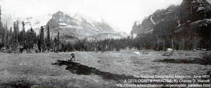
Camp Contentment Meadow, Above Lake O' Hara, At Foot of Mount Schaeffer
Photo by Charles D. Walcott
MOUNTAIN-BUILDING ON A GRAND SCALE
The study of the arched block of strata 16,000 feet or more in thickness from which the picturesque and impressive mountains and canyons have been carved has resulted in the discovery that the rocks in which the great Bow Valley is excavated form a part of the North American continental beds that were deposited in great fresh-water lakes before the waters of the ocean swept over the continent and began their task of depositing the 12,000 feet or more in thickness of rocks of Cambrian age that now contain the remains of the marine life of that period.
As the study of the formations developed it was found that in the eastward thrusting of the rocks massive limestones were often crushed and ground into fragments; in other places the thinner beds for 100 feet or more would be folded and crumbled between huge masses of even-bedded limestones that showed no traces of disturbance. In other places a series of beds, 1000 feet or more in thickness, met some obstacle which they could not crush or surmount, and were driven upward at almost right angles, forming series of sharp, ragged ridges. On the east side of the Lower Yoho Valley the limestones of Mount Ogden are lying nearly level, but on the eastern slope above Sherbrooke Lake Canyon the same beds are turned down at right angels and disappear beneath the canyon bottom. Everywhere the keen eye of the geologist will find evidence of mountain-building on a grand scale.
The panoramic photograph, taken by the author from Burgess Pass, 3,000 feet above Field, and published as a Supplement to this number of the NATIONAL GEOGRAPHIC MAGAZINE, shows at a glance over 9,000 feet in thickness of bedded rocks, 6,000 feet of it in an almost sheer cliff in the mass of Mount Stephen. Many thousand feet more may be seen to the westward in Mount Denis and in Mount Vaux. From Mount Stephen the eye follows to the left across the great canyon of the Kicking Horse River to the summit of Mount Field, two miles away, where the same limestone and shale beds carrying the same fossils indicate that thousands of feet in thickness and many millions cubic yards of hard rock have been removed by erosion from between the two mountains, Stephen and Field. From Mount Field a gentle slope carries the same beds northward through Mount Wapta, where they undulate across the President Range and plunge to the westward beneath the corrugated and more readily broken Ordovician rocks of the Van Horne Range.
EARLY MARINE LIFE
All of the Cambrian rocks were deposited in waters teeming with marine invertebrate life. As far as now known, this was before the day of fish or of any other vertebrate animal; land plants and even marine vegetable life were almost unrepresented. Other animals of the sea, however, existed in great profusion, and here and there conditions were so favorable for their burial in the mud and sand of the Cambrian sea that they were preserved unbroken, and throughout all the processes of rock-making and mountain building they have escaped destruction.
In one of these favorable places the most delicate of organisms, like the jellyfish, have been exquisitely preserved and we have crustaceans of many varieties. Among these many preserve the most delicate branchiæ and appendages, and one can hardly realize that they were buried in the mud 15 to 20 million years ago and have remained undisturbed while several miles of thickness of sediment were deposited over them, changed into rock, elevated into mountain masses, and later eroded into the present mountains and canyons.
We have long considered that the trilobite (page 516) was the most highly developed animal in the Cambrian time, but last summer a crustacean was found by the author in the fossil bed near Mount Wapta that was the king of the animal world in its day (page 517). That it was prepared to asset its right to the control of the Cambrian sea is shown by the claws with which it was armed.
To the geologist interested in the volcanic rocks a great field is waiting in the Selkirks to the west, and for generations to come there will be unsolved problems for the special student in this great region of mountains, glaciers, and rivers.
SUMMARY OF GEOLOGIC FORMATIONS
In the long panoramic view the rocks seen in the distance, forming Mount Balfour, belong to the Sherbrooke formation of the Upper Cambrian, or the most recent rocks of the Cambrian section. Beginning with these and going downward, the following formations are passed through:
UPPER CAMBRIAN
- Sherbrooke formation (mainly limestones) 1,375 feet
- Paget formation (limestones and shales) 360 feet
- Bosworth formation (limestone and shale) 1,855+
Total Upper Cambrian 3,590+
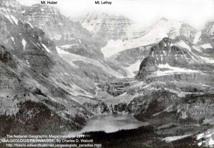
Lake O'Hara (6,664 Feet) Rests In A Bowl In The Mountains
From the lake to the top of Mount Lefroy 4,000 feet of Cambrian strata are seen in one unbroken section.
Photo by Charles D. Walcott
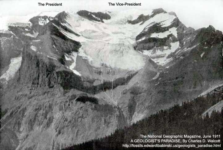
View Of The President Range From A Point On The Trail On The West Slope Of Mount Wapta, 3½ Miles In An Air Line North Of Field, On The Canadian Pacific Railway, British Columbia, Canada
This view shows Emerald Glacier after a light snow-storm has whitened the ice. Note particularly the two lateral moraines formed of broken-up light gray limestone (see page 520).
Photo by Charles D. Walcott
Waiting On The Burgess Trail Under Mount Wapta
Photo by Charles D. Walcott
MIDDLE CAMBRIAN
- Eldon formation (siliceous and arenaceceus limestones) 2,700 to 2,800
This is the formation that caps Mount Stephen and may of the higher mountains. - Stephen formation (limestones and shale) 620
- Cathedral formation (arenaceous limestones) 1,543
Total Middle Cambrian 4,963
LOWER CAMBRIAN
- Mount Whyte formation (limestones and sandstones) 390
- Saint Piratt formation (sandy shales and sandstones) 2,705
- Lake Louise formation (siliceous shale) 105
- Fairview formation (sandstones) 1,324
Total Lower Cambrian 4,524
SUMMARY
Upper Cambrian 3,590+
Middle Cambrian 3,963
Lower Cambrian 4,524
Total thickness of Cambrian section 13,077+
Beneath the old Cambrian sea-beach now forming the base of the Fairview formation there is a great series of sandstones and sandy shales of quite a different character. These rocks formed the land area which was submerged by the Cambrian sea that wore them away more or less in its advance over the continent.
These older rocks are supposed, owing to their character and the absence of marine fossils, to have been deposited in fresh water. They are referred to a series called Algonkian, and are divided into two formations:
- Hector formation (sandstones and shales-gray, black, greenish, purple in color)... total thickness.. 1,302
- Corral Creek formation (sandstones)...1,320
THE WASTING AWAY OF THE MOUNTAINS
The breaking down of the mountain summits by the action of rain, frost, and ice, so as to form strong pyramids and ridges, is constantly going on. This is well shown by the photograph of Mount Huber, on page 518.
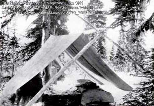
A Cool September Morning At 7,000 Feet Above Sea-Level
Photo by Charles D. Walcott
An illustration of a long summit ridge is given by Mount Daly, where every summr storm leaves a fresh coating of snow. I well recall stepping off that limestone onto the snow, thinking it hard and secure, and dropping in up to my armpits within a few feet of the rock. We were glad to paddle our way back and follow the rocky ridge for miles around to get back to camp.
Some of the deep canyons were filled up for 1,000 feet or more by dirt, gravel and boulders washed down from the sides of the mountains, probably during the great Glacial period. Upon the withdrawal of the ice this accumulated material was rapidly cut away, but occasionally masses of it are left high on the sides of a mountain, and often most fantastic forms result from its erosion where the finer beds of gravel and clay are hardened and protected above by blocks of sandstone and limestone. One of the most noteworthy examples is that of the so-called Hoodoos, on the slope of Mount Vaux, 18 miles west of Field.
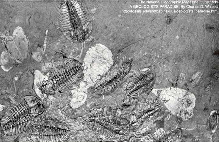
Fragments Of A Colony Of Marine Animals On A Slab Of Black Rock, With Many Trilobites (Dark) And Shells Of The Sidney Crab (Light), Whose Claws Are Shown On Page 517
These creatures and other animals, like the delicate jelly-fish, have been preserved many millions of years while sediment several miles deep was deposited over them (see page 511).
Photo by Thomas W. Smillie
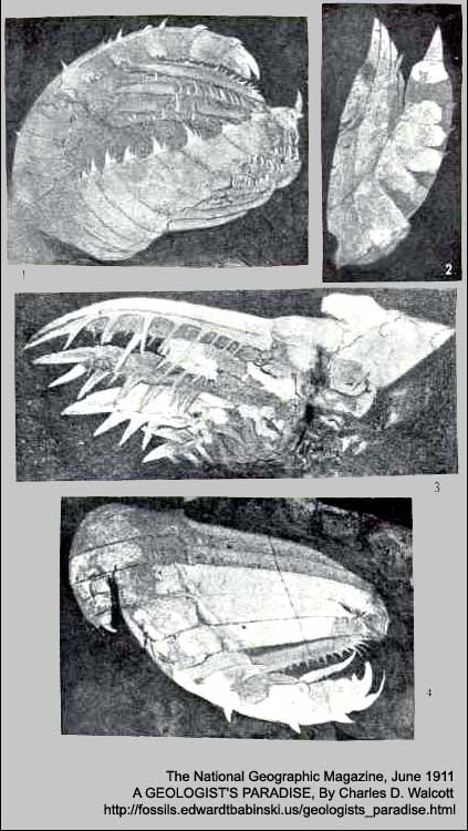
The King Of The Animal World 15 Million Years Ago; Discovered By Mr. W. Alcott
The Spiny claws of the Middle Cambrian crustacean (Sidneyia inexpectans), shown as a light patch in the center of the figure on page 516 (see page 511).
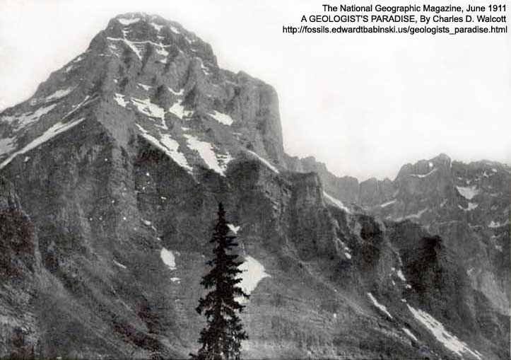
View Of Mount Huber, Showing The Erosion Of The Massive Cambrian Limestones Above The Quartite Sandstones
View taken from a low ridge of Lake O'Hara, six miles south of Hector, on the Canadian Pacific Railway, British Columbia, Canada (see page 514).
Photo by Charles D. Walcott
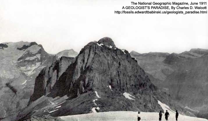
Cooling Off After A Hard Climb Up Through The Limestones
Panoramic view, at 9,000 feet, of the south face of Mount Wapta from the summit of Mount Field, 4,600 feet above Field, on the Canadian Pacific Railway, British Columbia, Canada.
Photo by Charles D. Walcott
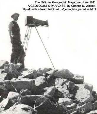
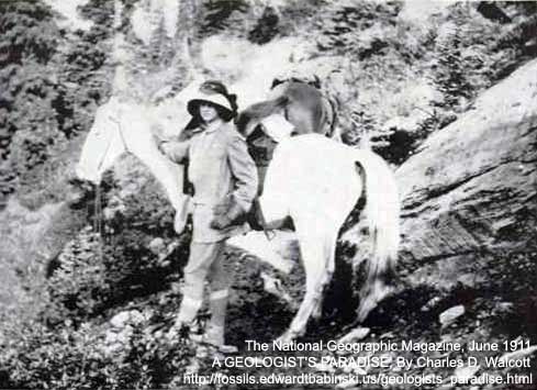
The Author Ready To Take A Panoramic View From Summit Of Mount Field
Photo by Sidney S. Walcott
TAKING THE PHOTOGRAPHS
The panoramic photographs were taken with the Cirkut camera that is used by newspaper men and others for photographing processions and obtaining panoramic views of buildings, railway lines, etc. For use in the mountains several minor changes were made, so that the instrument could be used successfully under such adverse conditions as strong winds, hands and fingers numbed from cold, and often very insecure foundation for the tripod. As it is necessary to have absolute stability and the camera-bed level, the securing of perfect negatives is difficult.
The camera consists of the ordinary 6½ by 8½ outfit, with a panoramic attachment which is 10½ inches square by4 inches in thickness. When the latter is used the tripod head is a 12-inch graduated circle with the revolving bed above A ratchet, driven by springs, moves the camera around the circle, the speed being governed by fans. Our lens is a Bausch and Lomb Zeiss Protar, Series VII.
The long panoramic view had an exposure of one-tenth of a second over each part of the film. The film moves past a vertical half-inch aperture from right to left as the camera is revolving from left to right. With this instrument a view can be taken 8½ inches in height and of any desired length up to 10 feet. Two persons can readily carry the outfit anywhere that one can ordinarily climb. Under unusually difficult conditions the camera can be drawn up by a rope.
Often in the Canadian Rockies days will pass in which the atmospheric conditions are unfavorable for an extended view--dust blown in the plains, smoke from forest fires, or the indefinate summer haze and cloudy weather interfering. The best conditions usually occur just after a heavy storm of either snow or rain has cleared the air.
One really great panoramic view and a half dozen fine smaller views is a successful season with the camera when it is used as an adjunct to hammer and compass in geologic work.
From the vicinity of the Burgess Pass camp the views were most beautiful and varied, and changed from hour to hour during the day and from day to day with the varying atmospheric conditions. Emerald Glacier, directly facing camp (page 513), was always attractive, whether in the bright sunlight, the gray light of early morning, the shadows of sunset, or when snow and fog were sweeping over the range, giving only now and then a glimpse of the ice and cliffs. The light-colored moraines on either side of its foot and the dark rocks afforded a beautiful setting for the glacier. Across the Yoho Pass the cliff of Mount Wapta stood in bold relief, with a steep slope of broken rock on the western side and a huge bank of snow on the eastern side of its south ridge.
Rising back of camp was the beautiful cliff of Mount Burgess, a favorite haunt of the mountain goat. At its eastern foot on the narrow ridge is the point where the great panoramic view was taken. Far below and almost at the foot of the great cliff is Emerald Lake, a spot famous for its scenic beauty. Our camp in the forest just below the ridge was visited quite frequently in September by heavy snow squalls that gave a welcome opportunity for a day's rest, reading, and cleaning up.
Our camp at Lake O'Hara was in a beautiful mountain meadow at the foot of Mount Shaffer. Morning and evening the views of the surrounding mountains were most inspiring. At this elevation (7,000 feet) snow squalls were not infrequent on the higher summits above, and on July 17 snow fell at the camp most of the day. From a slope of Mount Odaray, Lake O'Hara, resting like an emerald in a bowl of mountains (see page 512), reflected the glaciers of Mounts Lefroy and Hungabee.
Camping in the Canadian Rockies is a relatively simple affair if one is accustomed to going about with saddle and pack animals for conveyance. It is not difficult to obtain good camp outfits with horses and men, and much of the most beautiful scenery can be visited without riding on a trail or leaving wagon roads. Firewood and good water are well distributed and grass for the horses usually abundant.
OUR MOUNTAIN PANORAMA
NO ONE would be more surprised and delighted with Mr. Walcott's beautiful panoramic view, which is published as a Supplement to this number, than the American scientist whose discoveries gave a practical value to Daguerre's invention of photography, and the 100th anniversary of whose birth was celebrated last month. It s only 72 years since John William Draper in New York took the first photograph of a human face, but the progress in the photography art since then is amazing.
Mr. Walcott's panorama is the most marvelous mountain view that has ever been published, and is remarkable not only for its exceeding beauty, but also because of the many lessons in geography learned by studying it.
Readers of this Magazine who have attempted to take photographs in high altitudes can appreciate the combination of patience and skill required to secure a panorama like our Supplement. Weeks usually elapse before the weather is favorable, and then the slightest error of judgment may make the exposure a complete failure.
Perhaps equally difficult is the engraving, printing, and handling of 100,000 copies of 9-foot picture. For the success of this part of the publication the NATIONAL GEOGRAPHIC MAGAZINE takes pleasure in acknowledging its indebtedness to the Matthews-Northrup Works, of Buffalo.
A few copies of the panorama have been printed on heavy art mat paper suitable for framing, and may be obtained at the office of the National Geographic Society at 50 cents per copy.
SCENES IN THE CANADIAN ROCKIES
THE scenes in the Canadian Rockies, published on pages 522 to 530, are all from photographs by Rev. George Kinney, of Keremeos, B.C., Canada, who, with his companion, Duncan Phillips, has the distinction of being the first to ascend to the summit of Mount Robson, the highest mountain yet discovered in the Canadian Rockies.
Mount Robson is situated in the heart of the Rockies, some 50 or more miles north of Yellowhead Pass and hundreds of miles from civilization. The mountain can be reached ony by pack-train after long weeks of strenuous endeavor through trackless forests and muskeg.
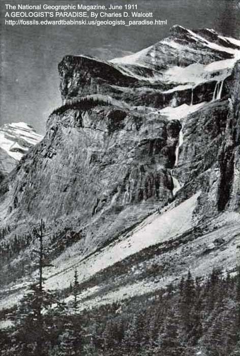
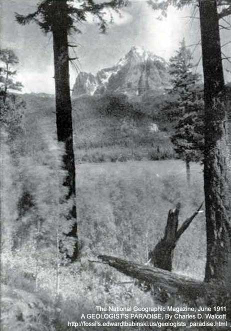
A Shoulder Of Mount Vice-President, Overlooking Emerald Lake, Near Field, British Columbia
The upper falls in the photograph are about 200 feet high.
Photo by Rev. George Kinney
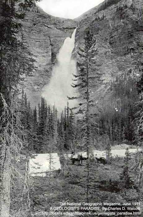
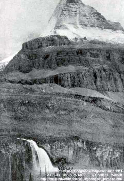
Takakkaw Falls (1,200 Feet), In The Valley Of The Yoho, British Columbia
Fed by the great Daly Glacier, which is backed by a snow-field of many square miles in extent, the Takakkaw Falls leaps full fledged over a cliff 1,200 feet high, thus forming the crowning wonder of the marvelous Valley of the Yoho, near Field, B.C., in the Canadian Rockies.
Photo by Rev. George Kinney
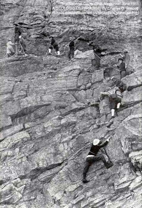
Members Of The Alpine Club Of Canada Ascending Mount Vice-President
A difficult piece of rock-work. Under the care of expert guides the members thus qualify for active membership.
Photo by Rev. George Kinney
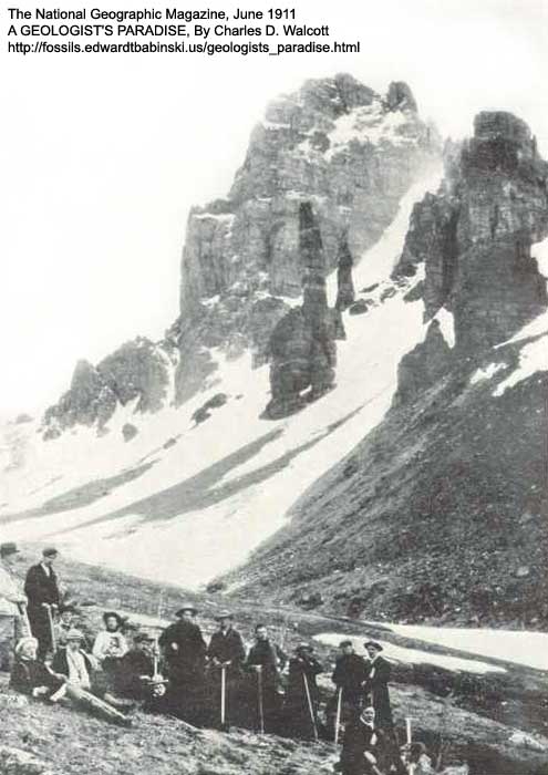
Mount Pinnacle and Sentinel Pass, Near Paradise Valley, British Columbia
This splendid peak, rising out of Paradise Valley like a jeweled needle tipped with pearl, stands side by side with Mount Temple, in the Canadian Rockies, and overlooks the celebrated "Valley of the Ten Peaks."
Photo by Rev. George Kinney
Mount Peelee And The Yellowhead Lakes: Canadian Rockies
Yellowhead Pass, sentineled by Mount Peelee and the Yellowhead Mountains, offers for the transcontinental railroads the lowest and easiest gateway through the Canadian Rockies. Gigantic Douglas firs make picturesque the shores of the lakes in this region.
Photo by Rev. George Kinney
Mount Wapta, Near Field, British Columbia, And The First Camp Of The Alpine Club Of Canada
Photo by Rev. George Kinney
Two Rope Parties Of The Alpine Club Of Canada Crossing The Great Snow-Field On The Summit Of Mount Vice-President, Near Field, British Columbia, At Over 10,000 Feet Altitude
Photo by Rev. George Kinney
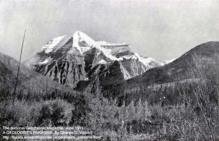
Mount Robson (Nearly 14,000 Feet Altitude), King Of The Canadian Rockies
As the tourist on the Grand Trunk Pacific will see it, from the mouth of the Grand Forks, on the Fraser River. This monster peak, towering over 10,000 feet above Lake Kinney, in the valley below, at an average angle of over 60 degrees, was finally captured, in 1909, by two Canadians, Rev. George R.B. Kinney and his companion, Donald Phillips. It is the highest mountain yet discovered in the Canadian Rockies.
Photo by Rev. George Kinney
The north face of Mount Robson rises abruptly in a series of precipitous cliffs, rank on rank, to the very skies. At its base the Grand Forks River, swiftly flowing from Berg Lake, leaps a cliff as high as a Niagara and, plunging in a succession of superb falls through a gorge over 3,000 feet deep, sweeps through the "Valley of a Thousand Falls" on its way to the Fraser.
Photo by Rev. George Kinney
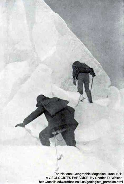
Climbing The Ice-Cliffs Of The East Side Of Mount Robson; Canadian Rockies
Dr. A.P. Coleman, L.Q. Coleman and Rev. George R.B. Kinney working their way up the fearful ice-cliffs of the east side of Mount Robson in their unsuccessful attempt to climb the mountain in 1908. Leaving their camp at tree-line, for 14 hours they fought their way up those treacherous walls of ice amid constant dangers from hidden crevasses and roaring avalanches, but only attained an altitude of 11,700 feet.
Photo by Rev. George Kinney
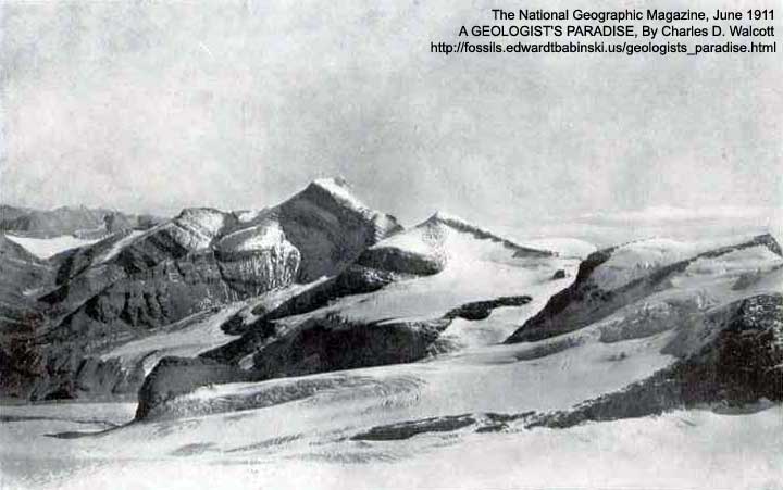
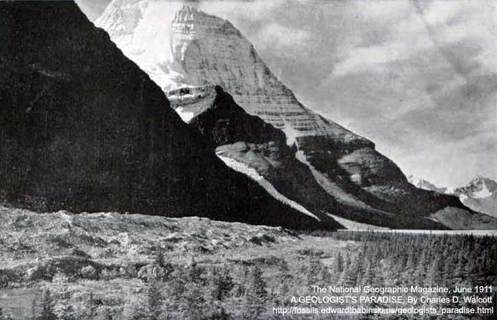
Looking East And South From Mount Robson; Canadian Rockies
This view was taken from the east side of Mount Robson at an altitude of over 10,000 feet, high up on the crumbling cliffs from which the great East Glacier flows. From this altitude the snow-capped peaks to the south spread out like the surface of a rugged plain.
Photo by Rev. George Kinney
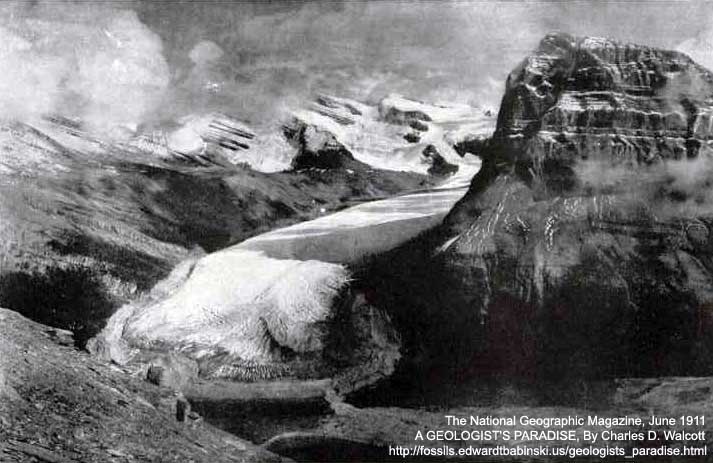
East Side Of Mount Robson, Canadian Rockies, From Timber Lake
Looking from the east, Mount Robson, in the Canadian Rockies, rises out of one of the most beautiful valleys in all the world of alpine scenery. Six mighty glaciers, the least of which measures not less than a quarter of a mile wide, flowing from his rugged sides and those of the mountains opposite, pour their turbulent streams into the quiet waters of Berg Lake. This lake received its name because of its surface being constantly dotted with huge icebergs that plung into it from Tumbling Glacier midway its length.
Photo by Rev. George Kinney
The Big Glacier On The East Of Mount Robson
This mighty glacier, flowing from a huge snow-field on the east side of Mount Robson and curving in a wide crescent around the base of Mount Rearguard, is a mile wide and five miles long. The glacier forms a watershed, part of its waters flowing into the Pacific and part into the Arctic seas.
Photo by Rev. George Kinney
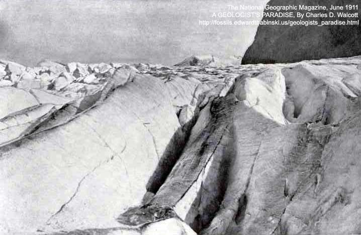
Surface Of The Big East Glacier Of Mount Robson
The crevasses of this glacier are in some places several hundred feet deep, while its lateral and terminal moraines are thrown high on every side, and a splendid medial moraine marks its course.
Photo by Rev. George Kinney
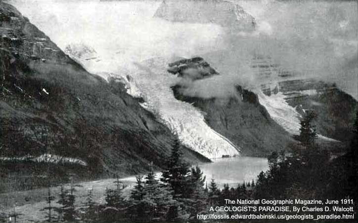
Mount Robson And Berg Lake From The Northeast: Canadian Rockies
So frightfully steep are its rugged sides, and so high does it rise out of its valleys (over 10,000 feet) and so frequent are the severe storms of the region that of all the expeditions that tried to capture Mount Robson, Mr. Kinney's, in 1909, was the only one that ever reached its summit. Even then he and his companions had to sleep several nights on its lofty snow-covered ledges and nearly perished.
Photo by Rev. George Kinney
REFERENCES
 The Complete National Geographic, 111 Years; 1888-2000
RECOMMENDED READING
- Creationist "Flood Geology" Versus Common Sense, -Or Reasons why "Flood Geology" was abandoned in the mid-1800s by Christian men of science
No comments:
Post a Comment